OUR PROJECTS TEVIOT SPATIAL PLAN
CLIENT: Central Otago District Council
DATE: 2023 - 2024
STATUS: Directly informing a Council-led plan change, charting future land use for the Teviot Valley over the next 30 years.
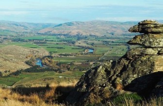
The Teviot Valley is a spectacular place that is characterised by the Clutha River / Mata-au which flows through the heart of the valley, contributing to the fertile plains that the area is known for. The rocky tussock-clad high country flanks a sheltered and lush valley floor of green and gold farmland and orchards.
The valley has fertile soils and a mild climate that create the perfect growing environment for world-class produce and salt-of-the-earth folk who care deeply for their community. The people who call Teviot Valley home have a strong legacy of working together to achieve common goals.
Central Otago is one of New Zealand’s fastest growing regions. While the Teviot Valley is not experiencing the same level of growth as observed in other areas, the community has asked to plan for ambitious growth projections, of fifty percent above projected growth rates. On these projections, capacity across the Teviot Valley would need to increase by 540 new homes over the next 30 years.
Future growth in the Teviot Valley is constrained by a number of factors, including natural hazards, productive land and groundwater protection zones – these factors have influenced where the Teviot’s settlements can grow. At the same time, wastewater infrastructure remains a constraint to growth in Ettrick and Millers Flat, until new reticulated systems are available. A potable water supply is also needed in Ettrick if further growth is to occur.


WHAT DID WE DO?
Developing a foundation for the project by developing a Project Design Report, Rationale mapped out a programme that would see the delivery of a Spatial Plan that would look at the future of Roxburgh and smaller settlements of Lake Roxburgh Village, Ettrick and Millers Flat.
This built on earlier work Rationale had undertaken for CODC, looking at both growth projections and a housing stocktake focused on the Teviot Valley.
Building on this foundation of evidence, we worked collaboratively with CODC and Boffa Miskell to develop the Spatial Plan.
The process had community engagement at the centre, ensuring the plans were driven by the community, balanced with the infrastructure servicing constraints of the area. Alongside CODC, Rationale gathered and analysed community feedback in many ways – through facilitated workshops, surveys, community drop-in events and online commentary.
Using the results of comprehensive community engagement, Rationale combined a range of optioneering and investment management tools such as Investment Logic Mapping and bespoke optioneering to help develop and analyse options for each town.
Utilising urban design expertise from Boffa Miskell, the plans were developed using best practise urban design principles delivered to meet National Planning Standards specifications.
WHAT WAS THE RESULT?
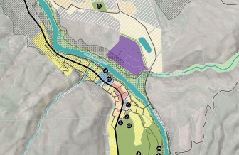
In December 2024 Council adopted the Teviot Spatial Plan – a visual blueprint for the next 30 years showing what could go where and how aspects such as infrastructure, housing and productive land use could fit together.
It is a vision of what the future could look like, offering guidance to the private and public sector, including direction for infrastructure investment and CODC’s future planning.
The Spatial Plan map for Roxburgh represents an accelerated approach to growth over the next 30 years. This has been achieved through a mix of infill, introduction of medium density residential zoning, consolidation of the commercial centre, new greenfield development, and a modest expansion into large lot residential zoning in Roxburgh East.
The Spatial Plan maps for Ettrick, Millers Flat and Lake Roxburgh Village set out a framework for growth that include the introduction of a Settlement Zone. This would enable a combination of residential and low-level commercial activity.
Importantly CODC have listened to the communities of the Teviot Valley and sought to understand their values, concerns and aspirations for the future. These views have been incorporated into the plan’s design.
The Teviot Spatial Plan will be used to inform a Council-led plan change, charting the land use in the valley for the next 30 years and beyond.
LEARN MORE
- View the Teviot Spatial Plan
OUR PEOPLE ON THIS PROJECT

OUR PROJECTS WHAT WE DO
TEVIOT SPATIAL PLAN
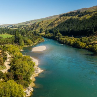
The Teviot Valley is a spectacular place that is characterised by the Clutha River / Mata-au which flows through the…
WORKING TO REDUCE WATER LOSS
As New Zealand grapples with aging water infrastructure and increasing demand, Rationale has been a key partner in helping Wellington…
MACKENZIE DISTRICT PLAN REVIEW
Mackenzie District Council (MDC) has successfully reviewed all chapters of its District Plan.

NZ DRIVER LICENSING IMPROVEMENT PROGRAMME
THE PROBLEM
More than one million people over 16 years who live in Aotearoa New Zealand currently do not have a…

CONSISTENT CONDITION DATA COLLECTION
The Te Ringa Maimoa Consistent Condition Data Collection (CCDC) project is a game changer for local road asset management in…

TE MANAWATAKI O TE PAPA
Tauranga’s city centre was failing to deliver the social, cultural, economic and environmental benefits expected of the fifth largest city…

SUPPORT THROUGH THREE WATERS UNCERTAINTY
Understanding how to fund the required investment in three waters is a significant challenge many local authorities are grappling with.
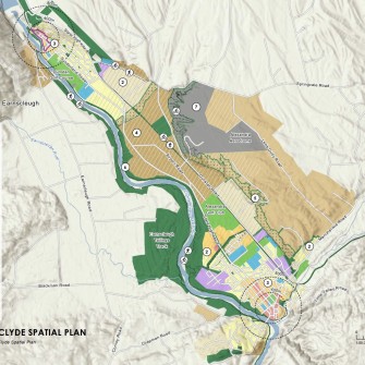
VINCENT SPATIAL PLAN
The Vincent area in Central Otago has an extraordinary and distinctive character.
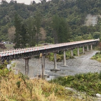
WEST COAST COMBINED TRANSPORT PLANNING
Since 2017, Rationale has been working with the three Council’s on New Zealand’s West Coast (Te Tai o Poutini) as…
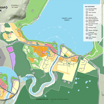
MACKENZIE SPATIAL PLANS
The Mackenzie District has been significantly impacted by unprecedented and sustained levels of growth over the past ten years.
THREE WATERS REFORM PLANNING BUSINESS CASE
Councils around the country are facing significant change and uncertainty in the three waters space, with significant government reform underway.

QUEENSTOWN TOWN CENTRE MASTERPLAN
The Queenstown Masterplan came about when a long period of under-investment in the town’s infrastructure inevitably collided with an ongoing…

KOPU MARINE PRECINCT BUSINESS CASE
The Thames Coromandel District is well known throughout New Zealand for its warm climate, beautiful beaches and bush-clad hills.

CORPORATE SERVICES FEASIBILITY STUDY
The Social Wellbeing Agency (SWA) is a central government organisation that supports social sector decision-makers, providing cross-social sector advice on…


